An evacuation order has been lifted for the community of Tumbler Ridge, B.C., after more than 2,000 residents were forced out by an encroaching wildfire last week.
A statement on the District of Tumbler Ridge website says an evacuation alert will remain in place indefinitely.
It says residents will still need to be ready to evacuate the area with little notice.
Residents were chased out on June 8 as a fast-moving fire approached the community. Recent rain and a change in the winds has calmed the West Kiskatinaw wildfire, although it remains classified as out of control.
For returning residents, DriveBC, the provincial government’s online travel information site, says Highway 52-N has reopened between Dawson Creek and Tumbler Ridge, and residents will also be able to use highways 29S and 52E, via the Kelly Lake Road.
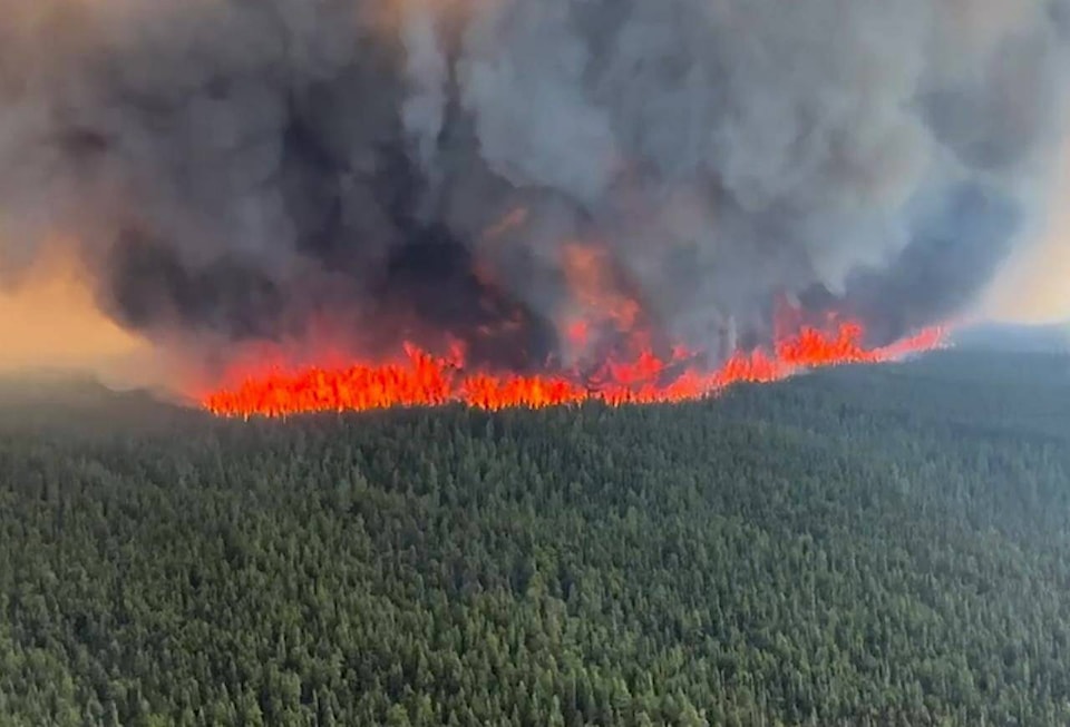
Meanwhile, cooler weather has stalled growth of another huge wildfire in northeastern British Columbia but the BC Wildfire Service says the Donnie Creek blaze remains just two kilometres from the Alaska Highway, southwest of Fort Nelson.
A statement from the wildfire service says travel on the key route linking Yukon and the northeast corner of B.C. to the rest of the province could be affected within a day or two as the nearly 4,900-square-kilometre wildfire expands.
An evacuation alert covers both sides of a section of the highway between Fort Nelson and Fort St. John and the wildfire service says teams are protecting critical infrastructure along the route and could use planned ignitions to create back burns to keep flames away from the road.
Rain has calmed the three large fires in the northeast, but conditions remain parched in the region.
Containment lines are holding around the Vancouver Island wildfire that closed Highway 4 east of Port Alberni on June 6, cutting off paved access to that city and the communities of Tofino and Ucluelet, but efforts to clear fallen trees and rocks are underway and the province has said limited travel could resume by next weekend.
The wildfire-ravaged Fraser Canyon community of Lytton is meanwhile holding a community meeting as it prepares to shed its long-running state of local emergency, allowing most residents to return and consider rebuilding, almost two years after flames engulfed the village.
READ ALSO: Despite rain, B.C. remains in a ‘tricky’ spot as wildfires continue across province
READ ALSO: Wildlife unseen casualty as forests burn in worst wildfire season of the century